


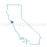
Voting District OCEAN, Marin County, California
About
Outline

Summary
| Unique Area Identifier | 534812 |
| Name | Voting District OCEAN |
| County | Marin County |
| State | California |
| Area (square miles) | 218.87 |
| Land Area (square miles) | 0.01 |
| Water Area (square miles) | 218.86 |
| % of Land Area | 0.00 |
| % of Water Area | 100.00 |
| Latitude of the Internal Point | 37.94717690 |
| Longtitude of the Internal Point | -122.78581560 |
Maps


Graphs
Select a template below for downloading or customizing gragh for Voting District OCEAN, Marin County, California


Neighbors
Neighoring Voting District (by Name) Neighboring Voting District on the Map
- Voting District 01051, San Francisco County, CA
- Voting District 02071, San Francisco County, CA
- Voting District 30230, Marin County, CA
- Voting District 40295, Marin County, CA
- Voting District 40320, Marin County, CA
- Voting District 40340, Marin County, CA
- Voting District 40350, Marin County, CA
- Voting District 51420, Sonoma County, CA
- Voting District OCEAN, Sonoma County, CA
Top 10 Neighboring County Subdivision (by Population) Neighboring County Subdivision on the Map
- San Francisco CCD, San Francisco County, CA (805,235)
- Russian River-Sonoma Coast CCD, Sonoma County, CA (22,713)
- Northwest Marin CCD, Marin County, CA (8,656)
- Bolinas CCD, Marin County, CA (2,999)
Top 10 Neighboring Place (by Population) Neighboring Place on the Map
- San Francisco city, CA (805,235)
- Bolinas CDP, CA (1,620)
- Bodega Bay CDP, CA (1,077)
- Stinson Beach CDP, CA (632)
- Muir Beach CDP, CA (310)
- Dillon Beach CDP, CA (283)
Top 10 Neighboring Elementary School District (by Population) Neighboring Elementary School District on the Map
- Mill Valley Elementary School District, CA (30,956)
- Sausalito Elementary School District, CA (10,671)
- Bolinas-Stinson Union Elementary School District, CA (2,339)
Top 10 Neighboring Secondary School District (by Population) Neighboring Secondary School District on the Map
Top 10 Neighboring Unified School District (by Population) Neighboring Unified School District on the Map
Top 10 Neighboring State Legislative District Lower Chamber (by Population) Neighboring State Legislative District Lower Chamber on the Map
- Assembly District 13, CA (444,835)
- Assembly District 1, CA (443,842)
- Assembly District 6, CA (433,034)
- Assembly District 12, CA (430,294)
Top 10 Neighboring State Legislative District Upper Chamber (by Population) Neighboring State Legislative District Upper Chamber on the Map
- State Senate District 2, CA (897,433)
- State Senate District 3, CA (880,421)
- State Senate District 8, CA (863,255)
Top 10 Neighboring 111th Congressional District (by Population) Neighboring 111th Congressional District on the Map
Top 10 Neighboring Census Tract (by Population) Neighboring Census Tract on the Map
- Census Tract 1543.02, Sonoma County, CA (3,747)
- Census Tract 601, San Francisco County, CA (3,235)
- Census Tract 1330, Marin County, CA (3,226)
- Census Tract 1543.04, Sonoma County, CA (2,400)
- Census Tract 1321, Marin County, CA (2,311)
- Census Tract 1322, Marin County, CA (1,774)
- Census Tract 1311, Marin County, CA (1,038)
- Census Tract 9901, San Francisco County, CA (0)
- Census Tract 9901, Marin County, CA (0)
- Census Tract 9901, Sonoma County, CA (0)
Top 10 Neighboring 5-Digit ZIP Code Tabulation Area (by Population) Neighboring 5-Digit ZIP Code Tabulation Area on the Map
- 94941, CA (30,496)
- 94965, CA (10,847)
- 94956, CA (1,756)
- 94924, CA (1,638)
- 94923, CA (1,411)
- 94937, CA (837)
- 94970, CA (683)
- 94971, CA (337)
- 94929, CA (264)
- 94972, CA (52)